

Peter's Model Railroading | The Layout | Overview
Hazel Mine Modules

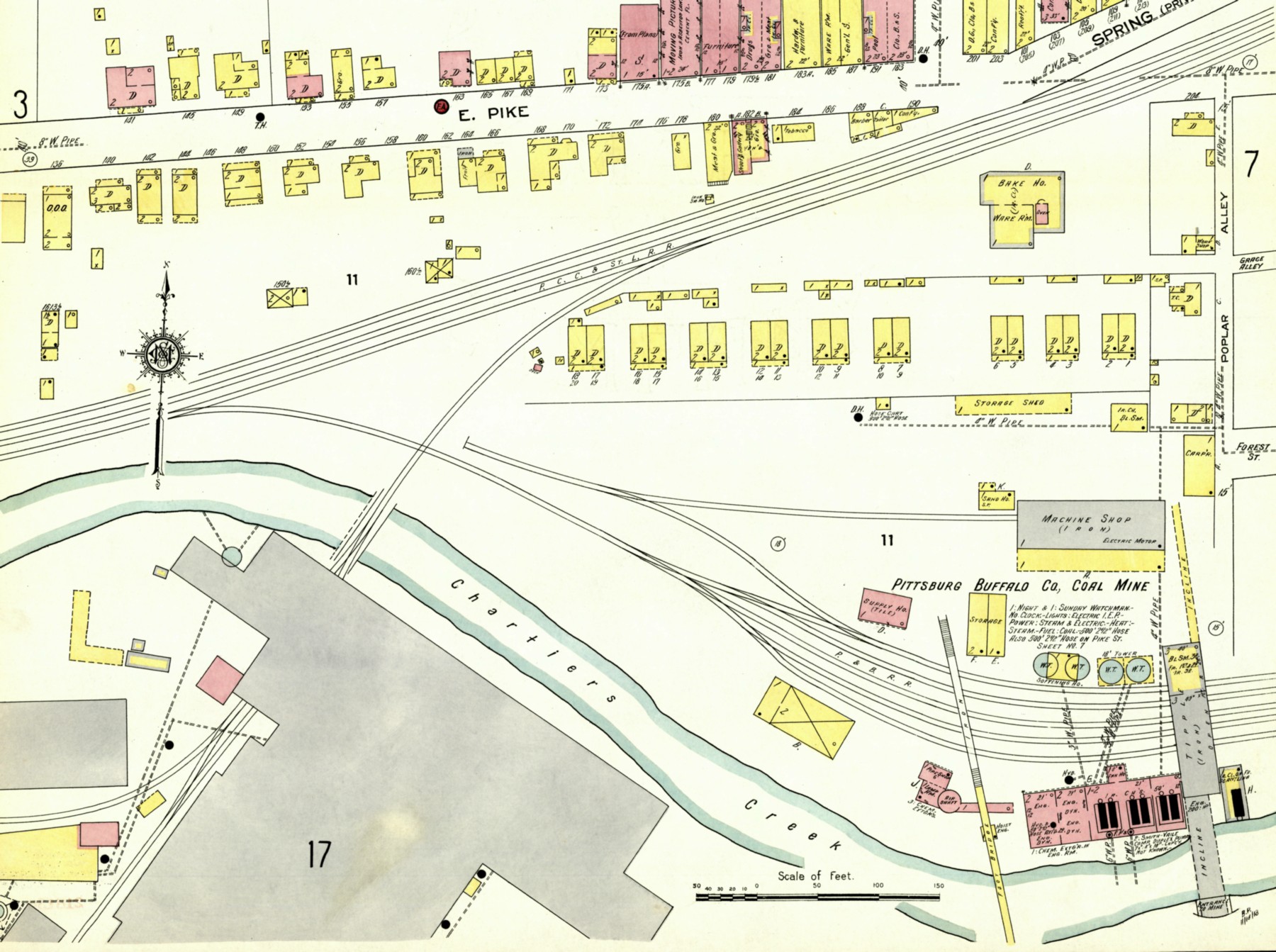
While I plan on having multiple scenes modeled as part of my overall layout, my current project is to build a 4-module scene centered around the Hazel Mine in Canonsburg, PA as it was in 1924. This Sanborn map is dated November 14, 1913. I'm hoping that not much has changed in the intervening 11 years between that and the year that I model, at least as far as major fixtures, such as track, structures, and countryside feature.
The Hazel mine complex is visible in the lower right-hand corner of the diagram.
The top two tracks going from center-left to upper-right near the top of the map are the main PRR branch line tracks. The branch line was double-tracked for a good portion of the line, including this area. The bottom track is a siding that connects to the Hazel mine (the left turnout) and to the Fort Pitt Bridge Works (marked #17; the right turnout). The Fort Pitt track actually ran through the building and served its facilities, as well as a number of smaller industries farther to the left of what is covered in this diagram. Much farther to the right than shown in this map, the Hazel mine yard tracks merge into one track, which then merges with the siding track again. So, operationally, the empties arrived from the left (southwest) in the map, and the loaded cars left to the right. The left side of the map goes south/southwest to Washington, PA, and the right side of the map goes north/northeast toward Pittsburgh, PA.
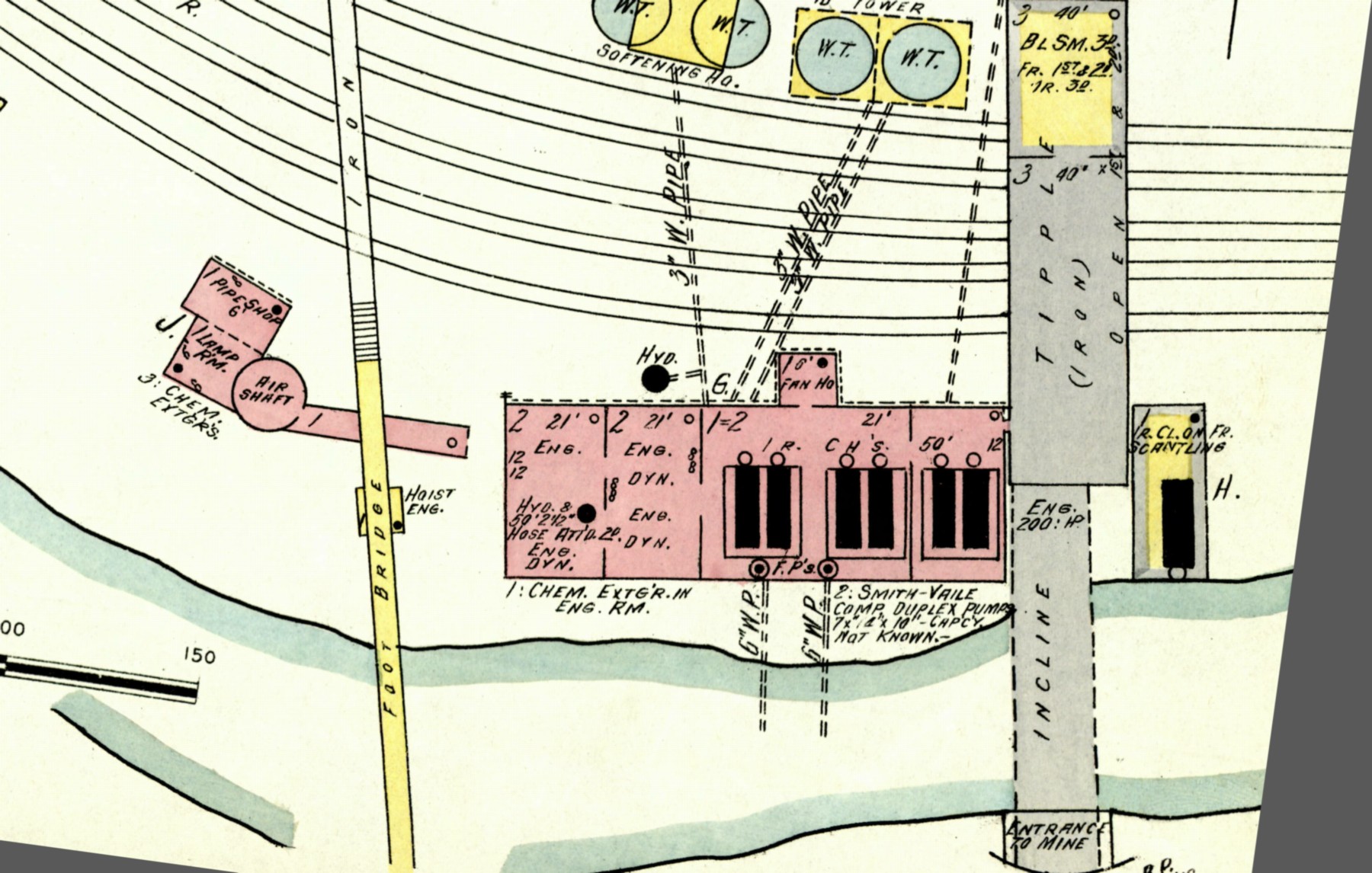
This portion of the Sanborn map shows the complete area that my four modules will cover. Unfortunately, the Hazel mine area was right at the bottom-right corner of the Sanborn map, so it is cut off quite a bit, especially on the right-hand side. I have rotated the map (by 7.8 degrees) to get it to line up and face the orientation that I model.
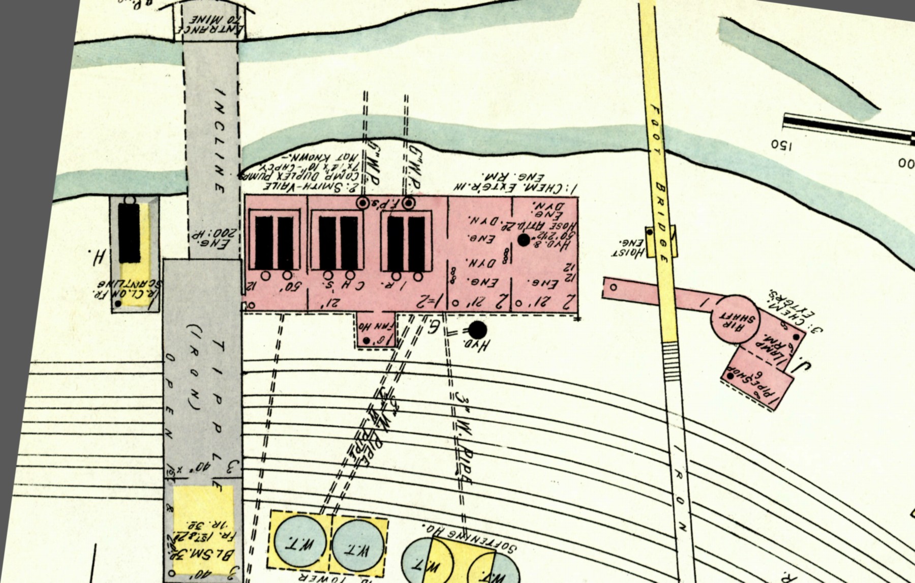
Actually, to be accurate, this orientation is the way my four modules will be facing, when standing in front of the layout (the tracks are at the front of the layout for easier access). Module #1 is the main Hazel Mine tipple (the gray rectangles). Module #2 is the outfeed yard on the left (not shown due to the cut-off of the Sanborn map, but it is just a continuation of the 5 storage tracks of the yard). Module #3 is the power house (the large pink rectangle) and the water towers at the bottom. Module #4 is the one on the right-hand side that includes the long bridge.

To give you an idea of why this mine needed 5 storage tracks, take a look at this 1904 diagram that shows the entire facility. This is oriented about 180 degrees from the normal Sanborn map. The small, slightly curving tracks on the bottom-left are the two main tracks of the Chartiers Branch. Coming off of that is the large Hazel mine yard. You can make out the Chartiers creek in the diagram. Across from it is Buffalo Hill. The actual mine goes deep under Bufallo Hill. The collosal mine is completely under the Hill. They actually had small electric trains and cars running throughout the multi-mile system.
Another thing to note is that Canonsburg-proper is on the Hazel mine tipple side of the Chartiers creek, while South Canonsburg is a separate town on the other side of the creek. So, Fort Pitt Bridge Works is actually in South Canonsburg.